The world’s longest road finally runs out of pavement here, dissolving into a shoreline of kelp and cold water where the Andes mountains sink into the sea.
About Tierra del Fuego National Park
Yaghan nomads survived these glacial winds for seven millennia, using whale blubber and constant fires to thrive in a landscape that later terrified European sailors. In the early 1900s, the region became a penal colony, with prisoners carving the first trails through the sub-antarctic forest to haul wood back to the fledgling city of Ushuaia. This era of extraction ended in 1947 when the prison closed, and the territory shifted toward conservation. The formal creation of the National Park in 1960 signaled a new philosophy, moving away from the colonial desire to 'tame' the southern wilderness and instead allowing the flag trees and peat bogs to reclaim their rightful, wind-swept dominion.
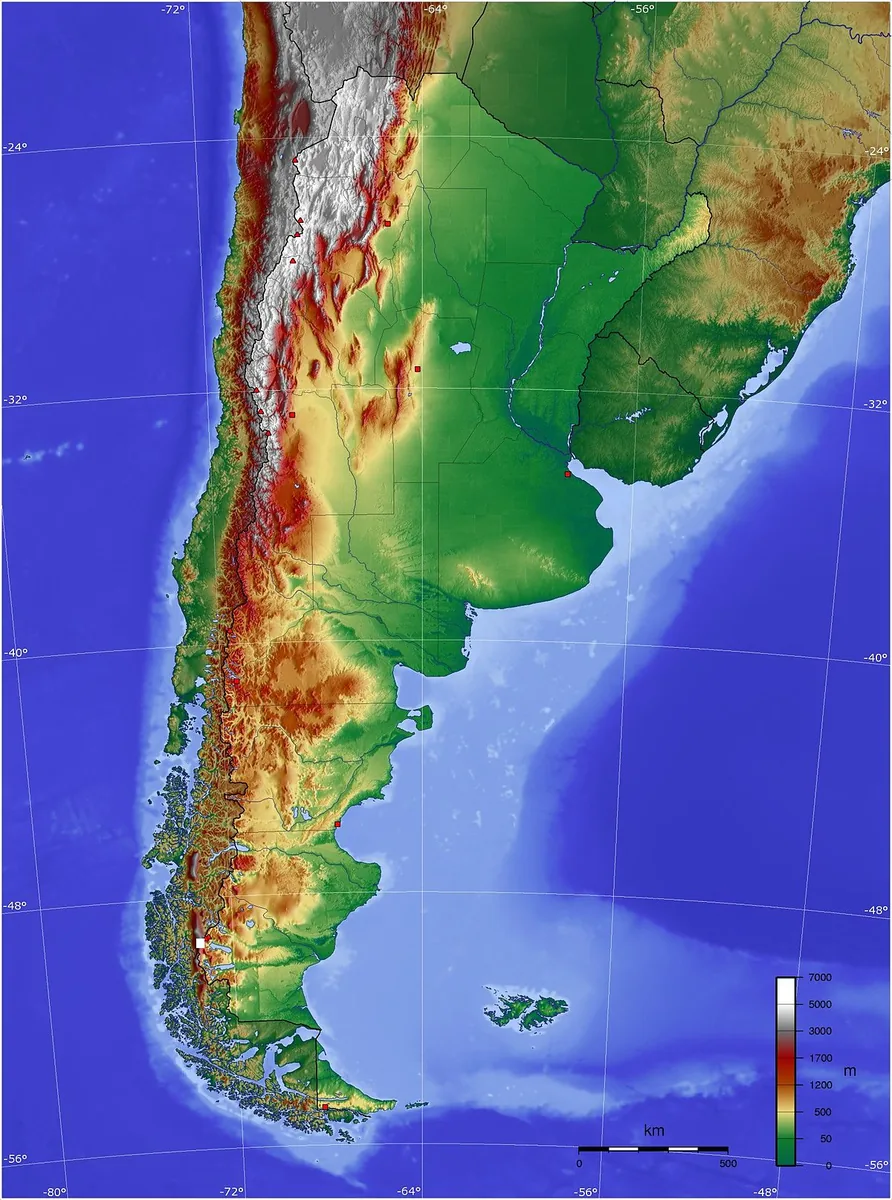
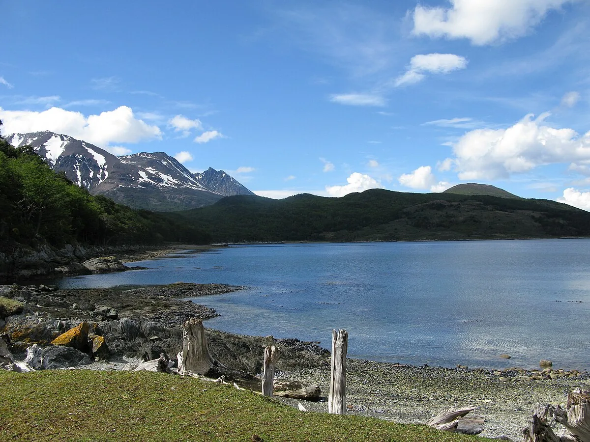
High-altitude peaks usually demand a long climb to reach the snowline, but at the southern tip of Argentina, the Andes finally surrender to the sea. Tierra del Fuego National Park protects sixty-three thousand hectares of sub-antarctic forest, peat bogs, and dramatic shorelines where the mountains literally dip their toes into the Beagle Channel. This is a landscape defined by the horizontal: the stunted growth of flag trees bent by relentless Antarctic winds and the glassy, ink-colored surfaces of glacial lakes like Acigami. It remains the only coastal national park in the country, a place where the air carries a crisp, ozone-rich scent that feels as though it hasn't been breathed by another human in a thousand miles.
“High-altitude peaks usually demand a long climb to reach the snowline, but at the southern tip of Argentina, the Andes finally surrender to the sea.”
Tierra del Fuego National Park, Argentina
Long before the arrival of European explorers, the Yaghan people navigated these frigid fjords in bark canoes, maintaining fires on their vessels that gave the region its name: Land of Fire. The establishment of the park in 1960 aimed to preserve this fragile ecosystem from the encroachment of the logging industry that had begun to scar the surrounding valleys. Much of the infrastructure you see today, including the tracks of the Southern Fuegian Railway, has a darker origin. Convicts from the notorious Ushuaia prison were once sent into these woods to harvest timber, enduring the brutal Patagonian winters as they laid the groundwork for what would eventually become a sanctuary. Today, the park stands as a triumph of regrowth, where the scars of the axe have been largely swallowed by the slow-growing southern beech and the emerald moss of the peat bogs.
Walking the coastal path toward Lapataia Bay, you feel the springy, deep crunch of organic matter beneath your boots. The silence of the forest is thick, broken only by the rhythmic drumming of a Magellanic woodpecker or the distant, lonely cry of an Andean condor. You notice the trees are draped in 'old man’s beard,' a pale green lichen that serves as a biological indicator of absolute air purity. Along the shoreline, the water of the Beagle Channel is so clear that you can see the giant kelp forests swaying like dark ribbons beneath the surface. The light here has a haunting, pearlescent quality, especially in the late afternoon when the sun hangs low and turns the snow-capped Darwin Range across the water into a wall of bruised purple and gold.
Ushuaia, the world’s southernmost city, sits just twelve kilometers to the east of the park’s entrance. Most visitors arrive via the 'End of the World' train, a steam-powered relic that chugs slowly through the Pipo River valley, offering a cinematic entry into the wilderness. For those who prefer a quieter approach, local shuttles depart regularly from the municipal pier, dropping hikers at various trailheads along the main gravel road. The park ends at the famous sign for National Route 3, marking the literal terminus of the Pan-American Highway. Standing there, knowing that the road stretching north only stops once it hits the Arctic Ocean in Alaska, provides a dizzying sense of scale that no map can replicate.
“Ushuaia, the world’s southernmost city, sits just twelve kilometers to the east of the park’s entrance.”
The Experience
You notice the silence first; it is a heavy, velvet quiet that seems to absorb sound rather than carry it. The wind off the Beagle Channel hits your face with a sharp, salt-crusted chill that forces you to pull your collar tight. As you walk the boardwalks at Lapataia, the light shifts rapidly from a bright, cold blue to a brooding slate gray, reflecting the volatile mood of the Southern Ocean. You feel the spongy, damp floor of the forest beneath your feet, a carpet of peat that has been accumulating since the last ice age. The moment that stays with you is standing at the end of the pier, watching the small, white-crested waves break against the rocks while a lone steamer duck skims across the surface.
Why It Matters
Tierra del Fuego National Park is a critical biological bridge, representing the final frontier of the sub-antarctic forest before it gives way to the sea. It preserves the cultural memory of the Yaghan people and serves as a living laboratory for studying the effects of extreme southerly climates on flora. Humanly, it represents the 'end of the world,' a psychological boundary where the continent finishes and the vast, unknown Antarctic begins.
Why Visit
Plenty of places have mountains and forests, but only this park offers the strange, lonely thrill of standing at the literal edge of a continent. It is the only place where you can hike through an Andean forest and end your day on a beach watching penguins. The geographic finality of the site gives every view a weight that more accessible parks simply cannot match.
Insider Tips
- 1
Head to the Ensenada Zaratiegui bay to find the world's southernmost post office, where you can get a unique passport stamp from a man who has lived there for decades.
- 2
Look for the 'Flag Trees'—Nothofagus specimens that have been permanently deformed by the wind into a horizontal growth pattern.
- 3
Avoid the morning rush of tour buses by starting your hike at the Lapataia end of the park and walking back toward the entrance.
- 4
Listen for the distinctive 'knock-knock' of the giant Magellanic Woodpecker, which is often heard long before its bright red head is seen against the dark bark.
- 5
Carry a high-quality windbreaker even on sunny days, as the proximity to the Southern Ocean means the weather can flip from calm to gale in under ten minutes.