At just 429 meters, Moldova's highest peak won't give you altitude sickness, but it will give you a view of a forested world where outlaws once lived in defiance of empires.
About Bălănești Hill
Bălănești Hill is part of the Central Moldovan Plateau, a geographical feature formed during the Neogene period. Unlike the surrounding plains, this area is characterized by deep valleys and sharp ridges, a result of the unique erosive properties of the local clay and sand layers. Historically, the hill was the center of a heavily forested region known as the 'Codri', which once covered nearly a third of the country. These forests were the primary source of timber for the fortress-building projects of Stephen the Great. In the late 19th century, the hill was mapped by Russian imperial surveyors who identified it as the 'Bessarabian Olympus'. Today, it is part of a protected landscape that aims to restore the ancient oak forests that once made this peak nearly inaccessible.
A modest summit rises 429 meters above the sea, crowned by a dense thicket of oaks and a silent weather station that keeps watch over the Codri forest. Bălănești Hill is the highest point in Moldova, a peak that feels more like a gentle, forested lung than a mountain. The air at the top is noticeably cooler and thinner than in the humid valleys of Chisinau, smelling of damp leaf mold, wild strawberries, and the sharp, clean scent of pine. You walk along a winding dirt track that snakes through the village of Bălănești, noticing how the traditional blue-painted houses give way to a steep, emerald slope. The soundscape is a tranquil tapestry of birdsong, the rustle of the wind in the high canopy, and the distant, rhythmic thud of a woodcutter’s axe echoing from the deep ravines below.
While the rest of the country was being smoothed by ancient rivers and prehistoric seas, the Bălănești-Cornești plateau was thrust upward by tectonic shifts that created the rugged heart of the Moldovan highlands. For centuries, this area was the ultimate sanctuary for the 'Haiducs'—local outlaws who used the impenetrable Codri forests and the high ridges to evade the authorities of the Ottoman Empire. The hill itself was never a site of great battles or grand monuments; instead, it served as a vital landmark for travelers navigating the dense woods between the Prut and the Dniester. During the 20th century, its height made it a strategic location for telecommunications and weather monitoring, leading to the construction of the metallic towers that now pierce the tree line. Despite these modern intrusions, the hill remains a symbol of the nation's geographical peak and a preserve for the ancient flora of the Central Moldovan Plateau.
Climbing the final stretch toward the summit, you feel the physical effort in your lungs as the path steepens through the cool shade of the hornbeam trees. You notice the way the light filters through the leaves in dusty, golden shafts, illuminating the vibrant moss that covers the north-facing stones. The sound of the world below—the barking dogs of the village and the hum of distant tractors—slowly fades until only the wind remains. You feel the sudden expansive opening of the view when you reach the clearing near the towers, where the rolling hills of Moldova appear like a frozen green sea stretching toward Romania. You notice the tiny, white anemones that carpet the forest floor in the spring, a delicate contrast to the massive, ancient oaks. The most rewarding moment is the quiet realization that you are standing on the very roof of the country, looking out over a landscape that hasn't changed its silhouette in millennia.
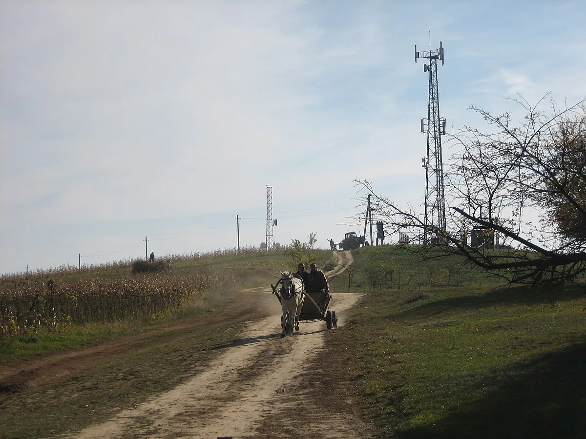
Bălănești is located in the Nisporeni district, roughly ninety minutes west of the capital. The drive involves navigating some of the country’s most scenic and winding roads, which can be quite muddy after a heavy rain. Once you reach the village of Bălănești, the path to the summit starts near the local school and is a straightforward, if somewhat strenuous, forty-minute hike. There are no paved roads to the very top, preserving the quiet, natural character of the ascent. Arriving in the early morning ensures the clearest views before the afternoon haze sets in, and packing a picnic is essential as there are no commercial facilities at the summit. It is a journey of quiet observation rather than grand spectacle.
The Experience
The atmosphere at the summit is one of peaceful, elevated isolation. You notice the smell of the forest—it is deeper and more complex here, a mix of decomposing wood and fresh growth. You feel the height not as a dizziness, but as a clarity of perspective that is rare in the lowlands. The light is soft and dappled under the trees but turns into a bright, panoramic glare in the summit clearings. You notice the small weather instruments and antennas, a strange, silent technological colony in the middle of the woods. The most striking detail is the sight of the Prut River valley in the distance, a silver line that marks the edge of the world. It is a place that rewards the slow traveler.
Why It Matters
Bălănești Hill is the geographical apex of Moldova and the highest point of the entire region between the Carpathian Mountains and the Dniester River. It represents the natural diversity of the Moldovan landscape, standing in stark contrast to the southern steppes. Culturally, it is a point of national pride and a favorite destination for local hikers and nature enthusiasts.
Why Visit
Visit because you need to reach the top. While Moldova is often described as flat, Bălănești proves that the country has a rugged, vertical heart. You come here to stand in the ancient Codri forest and to see the horizon as the haiducs saw it five hundred years ago. It is the only place where you can look down on the rest of Moldova and feel the true scale of the land.
✦ Photo Gallery
Best Season
🌤 May is the best time to visit, as the forest is a vibrant, neon green and the spring wildflowers are in full bloom, making the hike up from the village feel like a walk through a garden.
Quick Facts
Location
Moldova
Type
attraction
Coordinates
47.2172°, 28.0831°
Learn More
Wikipedia article available
Insider Tips
- 1
The trail is not always well-marked; look for the metal telecommunications towers as your primary North Star during the climb.
- 2
Wear long trousers and use tick repellent; the high grass in the summit clearings is a prime habitat for local ticks.
- 3
The village of Bălănești at the base of the hill is famous for its traditional weavers; ask around for a 'covor' (rug) demonstration.
- 4
Bring binoculars; on a very clear day, you can see the first ridges of the Romanian Carpathians to the west.
- 5
The descent is much faster than the climb, but the clay soil can be incredibly slippery when wet—tread carefully.