To create these enormous desert portraits, ancient artists moved thousands of tons of rock to draw shapes they themselves would never see from the air.
About Nazca Lines
The Nazca culture flourished in the southern coastal desert of Peru, leaving behind these geoglyphs as their most visible legacy. After the civilization's decline, the lines were forgotten by the wider world until the advent of commercial aviation in the early 20th century. In 1994, UNESCO designated the area a World Heritage Site, acknowledging the unique artistic achievement of a people who could conceptualize such massive scale without the aid of flight. Today, drone technology continues to reveal new, smaller geoglyphs hidden on the surrounding hillsides, proving the desert has yet to give up all its secrets.
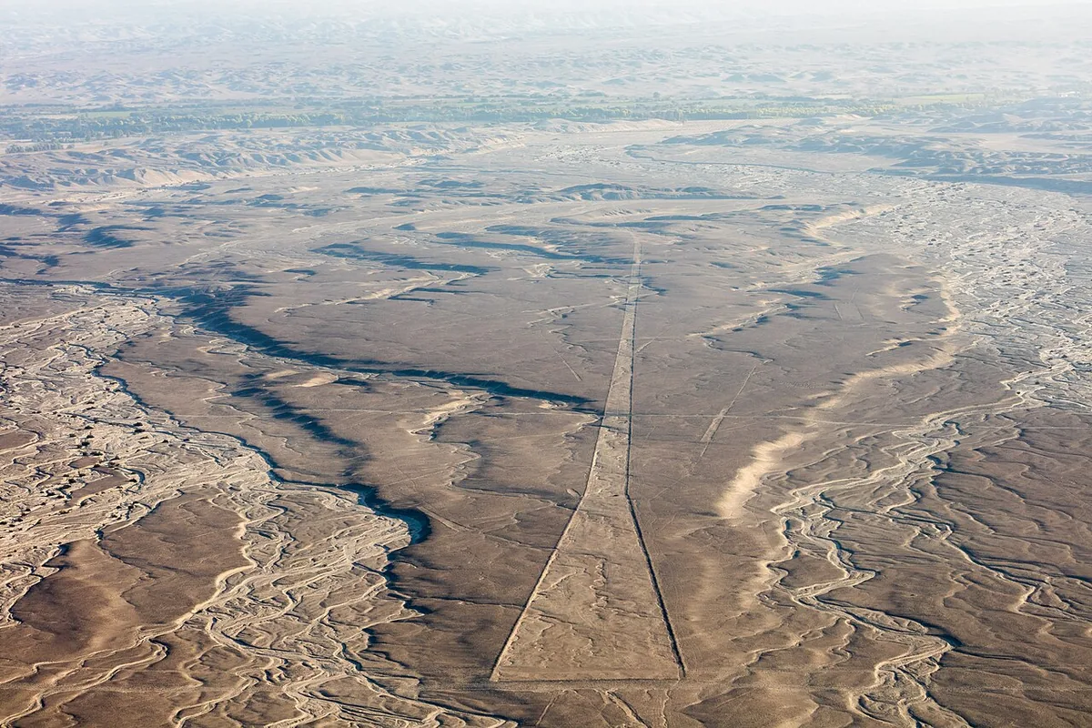
Etched into the iron-rich crust of the arid Pampa de San José, the Nazca Lines represent one of the most enduring enigmas of the ancient world. These geoglyphs, spanning hundreds of square kilometers, consist of straight lines, geometric shapes, and stylized biological figures like spiders, hummingbirds, and monkeys. The desert floor here is a dark, sun-blackened pavement of pebbles, which the ancient Nazca people scraped away to reveal the lighter sand beneath. The lack of wind and rain in this hyper-arid region has preserved these shallow furrows for nearly two millennia. From the ground, the lines appear as nothing more than dusty footpaths, but from the air, they resolve into a staggering celestial gallery. The experience of seeing them involves a dizzying perspective shift, as the scale of the drawings challenges every modern assumption about primitive survey techniques.
Between 500 BC and 500 AD, the Nazca culture thrived in these river oases, creating sophisticated irrigation systems and vibrant textiles. The geoglyphs were likely part of an enormous outdoor temple complex related to water rituals and astronomical observations. Paul Kosok, an American scientist, famously noticed the lines in 1941 while flying over the desert, realizing that some aligned perfectly with the winter solstice. His work was continued by Maria Reiche, a German mathematician who spent forty years living in a small hut near the desert, sweeping the lines with a broom to keep them visible. She became the desert's most fierce protector, theorizing that the lines served as a giant astronomical calendar. While modern archaeologists lean toward the idea of sacred processional paths used to petition the gods for rain, the mathematical precision remains a source of intense academic debate.
Boarding a small Cessna at the Maria Reiche airport, you notice the dry, metallic scent of the desert air and the heat radiating from the asphalt. The sound of the engine drowns out everything as the plane banks sharply, a necessary maneuver to allow passengers on both sides to spot the figures. You notice the Hummingbird first, its needle-like beak stretching across the plateau with a geometric grace that seems impossible from such a low altitude. The light at mid-morning is harsh, casting sharp shadows that help the shallow lines pop against the dark desert varnish. You feel a strange sense of vertigo as the pilot points out the 'Astronaut,' a humanoid figure waving from a hillside that looks like a modern doodle in an ancient world. Most visitors miss the hundreds of straight lines that run for miles without a single degree of deviation, far more numerous than the animals themselves.
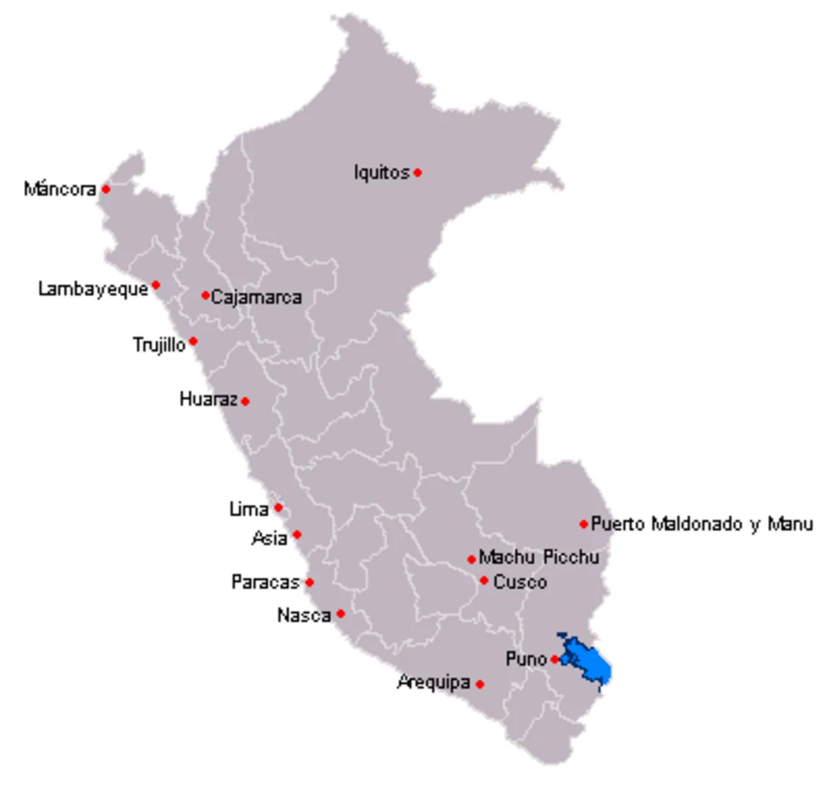
Nazca is roughly 450 kilometers south of Lima, a six-hour journey along the Pan-American Highway. Most travelers arrive via luxury bus from Lima, Paracas, or Arequipa. The flights depart from the local airport in Nazca, though longer flights from Pisco are also available for those who wish to skip the final leg of the drive. The desert is a protected zone, and walking on the lines is strictly forbidden, making the aerial tour the only way to truly comprehend the site's complexity.
The Experience
You notice the stomach-flipping turns of the small aircraft as the pilot maneuvers to give everyone a glimpse of the Spider. The glare of the sun on the ochre earth makes the lighter lines look like white scars on the landscape. You feel a profound sense of isolation looking out over the vast, empty pampa, wondering at the sheer patience required to scrape these shapes into the crust. Most visitors are so focused on the Monkey that they overlook the massive trapezoids that resemble ancient landing strips. The moment that stays with you is the final pass over the 'Tree,' where the scale of the artwork finally makes the human world seem very small indeed.
Why It Matters
The Nazca Lines are a testament to the sophisticated understanding of geometry and celestial mechanics possessed by pre-Columbian societies. They represent a unique form of land art that bridges the gap between archaeology and astronomy. Their preservation offers a rare, direct link to the spiritual life of a culture that viewed the very earth as a canvas for the divine.
Why Visit
Visit Nazca if you want to confront a mystery that defies easy explanation. While Machu Picchu is about the heights of stone, Nazca is about the breadth of the earth. It is the only place in the world where you can fly over a 2,000-year-old art gallery that looks more like a message to the stars than a monument for men.
✦ Photo Gallery
Best Season
🌤 December to March offers the clearest skies and least wind, though the heat can be intense; go in the early morning for the best visibility and smoothest flight.
Quick Facts
Location
Peru
Type
attraction
Coordinates
-14.6975°, -75.1350°
Learn More
Wikipedia article available
Insider Tips
- 1
Avoid eating a heavy breakfast before your flight, as the tight turns of the small planes can be difficult for even the strongest stomachs.
- 2
Book the earliest flight possible to avoid the midday haze that can blur the fine lines from the air.
- 3
If flying isn't for you, there is an observation tower on the Pan-American Highway that provides a close-up, though limited, view of two figures.
- 4
Check that your flight includes a co-pilot, as they are often better at spotting and pointing out the figures than the pilot alone.
- 5
Bring your passport to the airport, as it is required for check-in on all overflights.