Explore
Landmarks & Places
Must-see destinations across Philippines
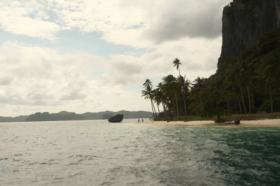
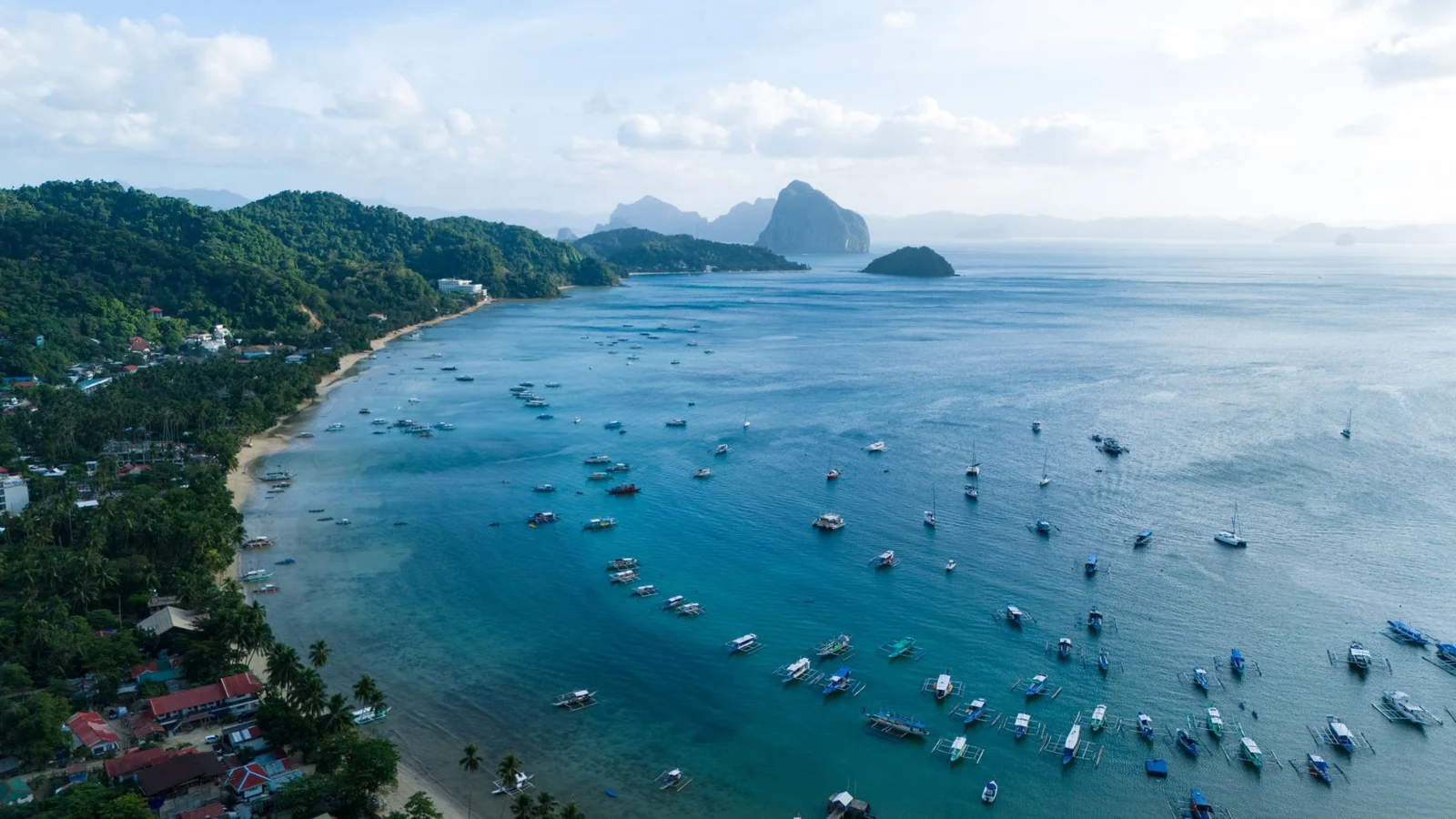
El Nido
Limestone karst cliffs rise straight out of water so clear you can count the fish from a kayak. The lagoons — Big and Small — are surrounded by walls of jungle-covered rock that block out everything except the sound of water dripping off stalactites. It gets crowded by midday but the 6am boat tours are still almost empty, and that's the only way to do it properly.
Explore →
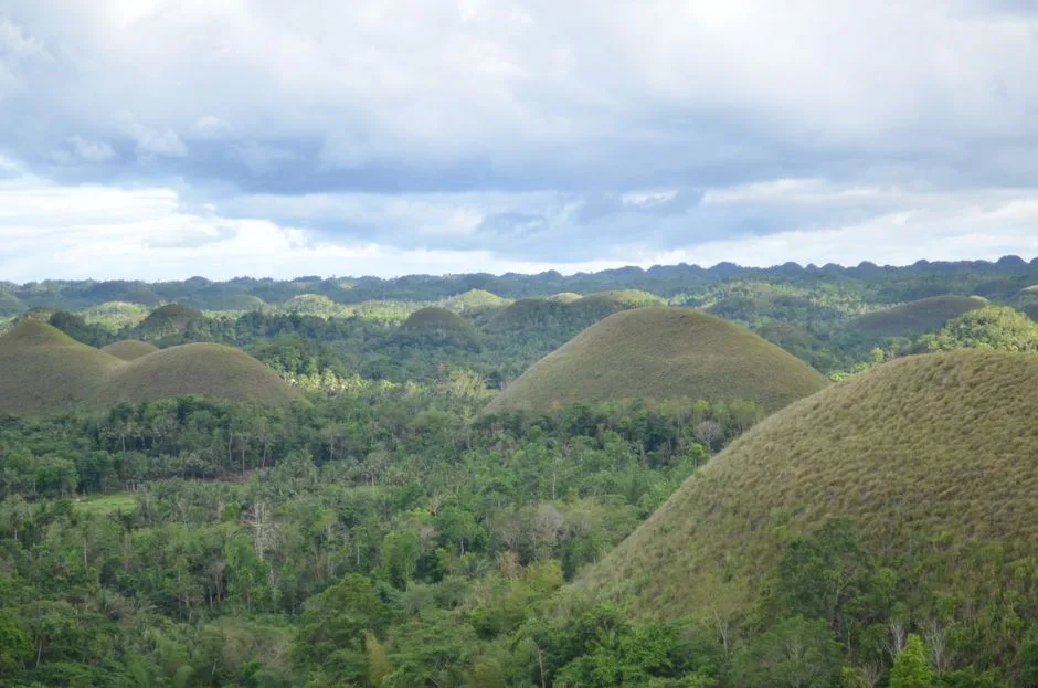
Chocolate Hills
Over 1,200 grass-covered limestone mounds spread across 50 square kilometres, turning brown in the dry season and earning the name. The viewing deck at Carmen gives the best panorama but the real trick is renting a scooter and riding through the hills at ground level where the scale actually hits you. They're geological oddities — coral deposits lifted by tectonic activity — and they look completely unreal.
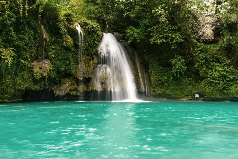
Kawasan Falls
A three-tier turquoise waterfall fed by natural springs in Badian. The water is genuinely that blue-green, not a filter trick — it's the limestone bed reflecting light. You can canyoneer down from the upper falls through a series of jumps and slides for about 1,500 pesos, and its one of the better adrenaline rushes in Southeast Asia. The bamboo rafts at the base pool are worth the 500 pesos.
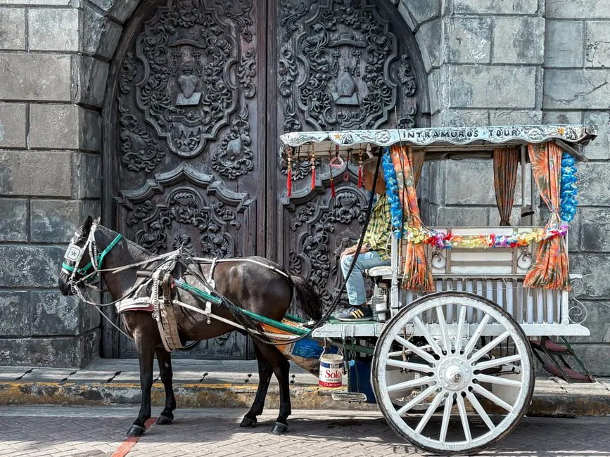
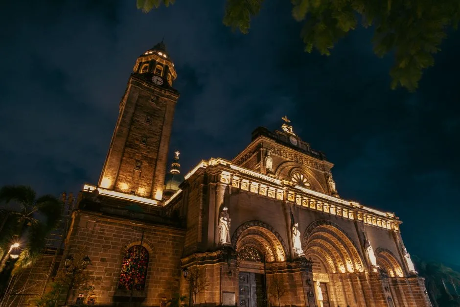
Intramuros
The old walled city the Spanish built in the 1570s, heavily bombed in 1945, partially rebuilt since. Fort Santiago at the northern end is where Jose Rizal was imprisoned before his execution. The San Agustin Church — the only building to survive the war intact — has a trompe-l'oeil ceiling that took Italian artists years to finish. Walk the walls at sunset when the heat drops and the light gets good.
Cloud 9
A reef break that puts out one of the most consistent right-hand barrel waves in the Pacific. The wooden boardwalk tower is the viewing spot even if you don't surf — watching the locals thread through hollow waves at dawn is free entertainment. The island itself has transformed from a fishing village into a surf-and-coconut scene but hasn't lost its edge yet. General Luna town has the food and the nightlife.
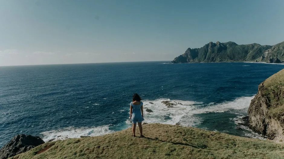
Batan Island
The northernmost inhabited islands of the Philippines, closer to Taiwan than to Manila. Stone houses with metre-thick walls built to withstand typhoons, rolling green hills that look more like Scotland than Southeast Asia, and a population of about 17,000. The Valugan Boulder Beach has massive rocks smoothed by centuries of Pacific storms. It's remote — flights from Manila are weather-dependent and cancel often.
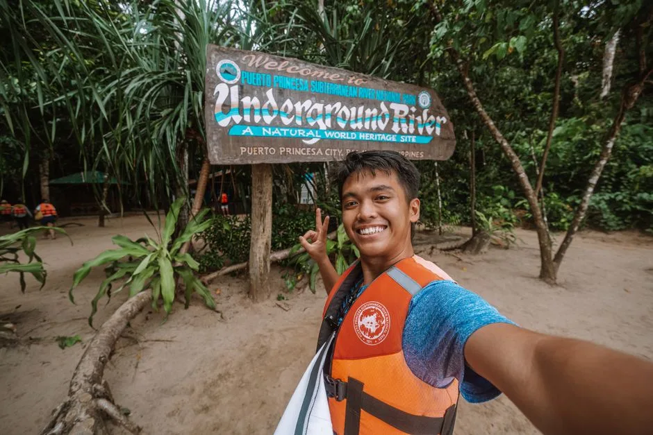
Puerto Princesa Underground River
An 8.2-kilometre navigable underground river that flows directly into the South China Sea. The cavern system has cathedral-sized chambers with stalactites and stalagmites formed over millions of years. The boat tour covers about 4 kilometres and the guides use spotlights to point out formations shaped like horses and mushrooms. You need a permit — book through the tourist office a day ahead because daily entries are capped.
Magellan's Cross
A wooden cross planted by Ferdinand Magellan's crew in 1521 to mark the first Christian baptism in the Philippines. The original cross is supposedly encased inside the current one — locals kept chipping pieces off as relics. It sits in a small octagonal chapel on the Cebu City waterfront near the Basilica del Santo Nino. The ceiling murals depicting the baptism scene are more interesting than the cross itself.
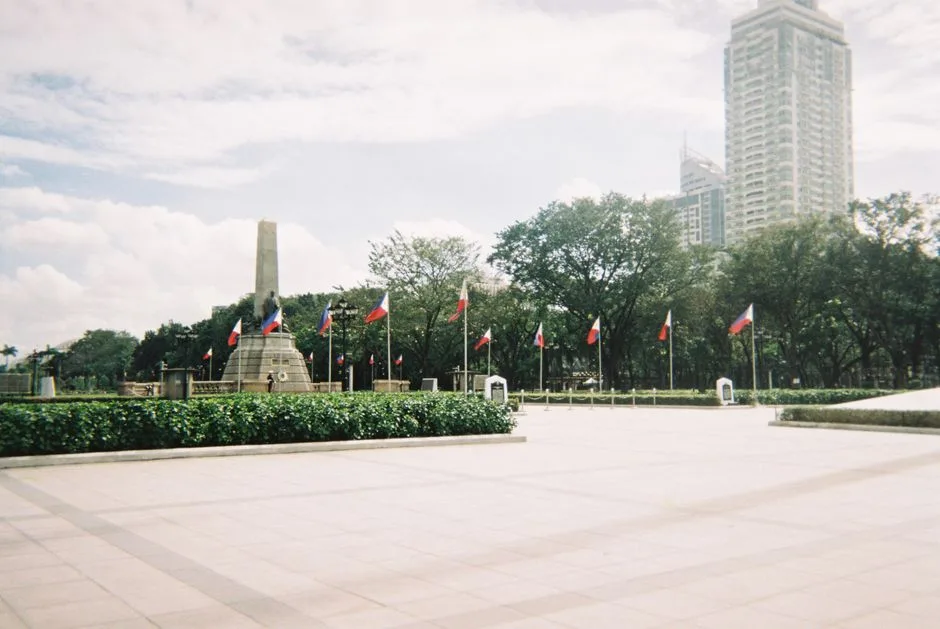
Rizal Park
A 58-hectare park in the heart of Manila named after the national hero Jose Rizal, who was executed here by Spanish colonial authorities in 1896. The relief map of the Philippines near the children's playground is enormous and worth finding. The park connects to the National Museum complex — the National Museum of Fine Arts and Natural History are both free entry and genuinely world class, which surprises most visitors.
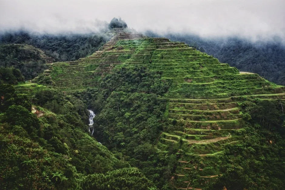
Banaue Rice Terraces
Hand-carved into the mountains by Ifugao ancestors over 2,000 years ago, these terraces climb to an elevation of 1,500 metres. UNESCO listed them but also flagged them as endangered because younger Ifugao are leaving the farming life. The main viewpoint is on the road above town but hiring a local guide to hike down into the terraces and through the villages is the actual experience. Expect mud and leeches in the wet season.
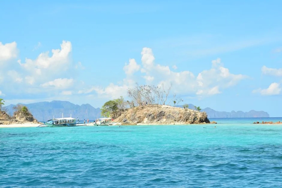
Coron Island
Japanese warships sunk during World War II sit in the shallow waters around this island, making it one of the best wreck diving destinations in the world. The Barracuda Lake — half freshwater on top, hot saltwater underneath — creates a thermocline effect that messes with your depth perception. Kayangan Lake behind the limestone cliffs is the postcard shot but the climb up and over the rocks in the heat is brutal.
Siquijor Island
Known locally as the 'Island of Fire' for the bioluminescent fireflies that covered it when Spanish colonisers first arrived. The island has a reputation for folk healing and sorcery — the annual healing festival in San Antonio draws herbalists from across the Visayas. Beyond the mystique its actually just a quiet, beautiful island with century-old balete trees, cliff jumps at Salagdoong Beach and very few tourists.
White Beach
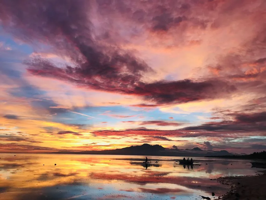
A 4-kilometre stretch of powdery white sand that was the Philippines' biggest tourism draw until the government shut it down for six months in 2018 to clean up sewage and overdevelopment. It reopened cleaner but still gets packed in peak season. Station 1 at the north end is the quietest section with the widest beach. The sunsets here are legitimately spectacular — the whole sky goes orange and the sailboats become silhouettes.

MacArthur Landing Memorial
The bronze statues of General Douglas MacArthur and his officers wading ashore at Red Beach in Palo mark the moment the Americans returned to liberate the Philippines in October 1944. The memorial is slightly kitschy but the history is significant — the Battle of Leyte Gulf that followed was the largest naval battle in history. The lagoon is shallow and you can wade out to where the statues stand.
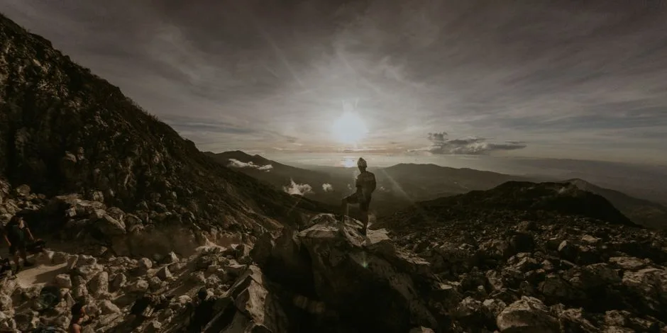
Mount Apo
The highest peak in the Philippines at 2,954 metres. The two-to-three day climb passes through rainforest, sulphur vents, and mossy boulder fields before reaching the summit with views across Mindanao. You need a climbing permit and a registered guide — the mountain is sacred to the indigenous Bagobo people. The hot springs at Lake Agco on the eastern approach are a good staging point and a reward on the way back down.
White Island
A sandbar in the middle of the sea off Camiguin's north coast — no trees, no shade, just white sand surrounded by turquoise water with the volcanic peak of Mount Hibok-Hibok rising behind it. You get there by outrigger boat from Mambajao and the boatmen wait while you swim. Bring your own shade because there is literally none. Best visited early morning before the sun gets punishing.
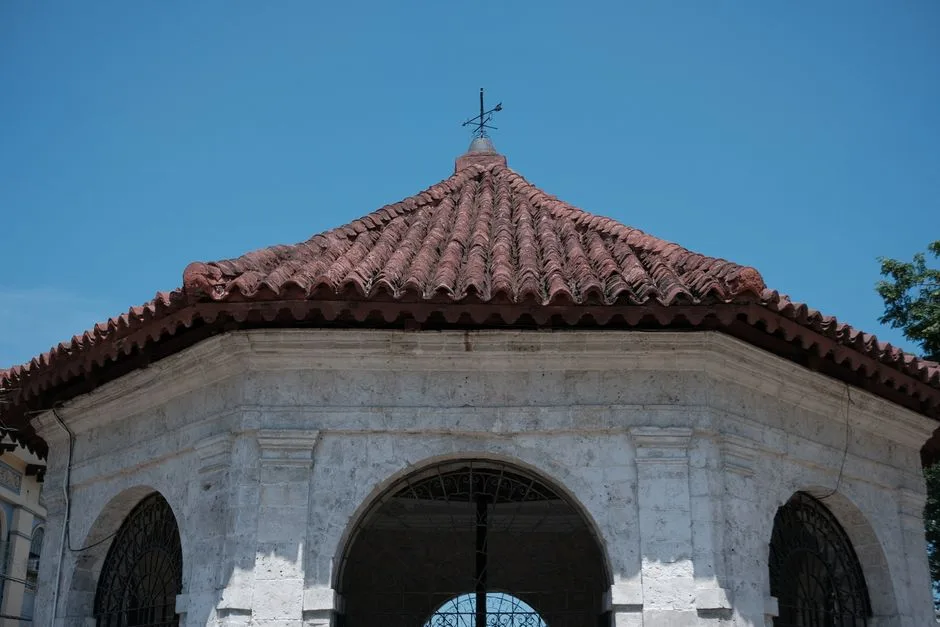
San Agustin Church
Built in 1607 and the oldest stone church in the Philippines, this Baroque structure is the only building within Intramuros that survived the Battle of Manila in 1945. The interior has 14 side chapels and a trompe-l'oeil ceiling painted by two Italian artists — Giovanni Dibella and Cesare Alberoni — that creates the illusion of a vaulted dome. The attached museum has religious artifacts and a peaceful courtyard garden.
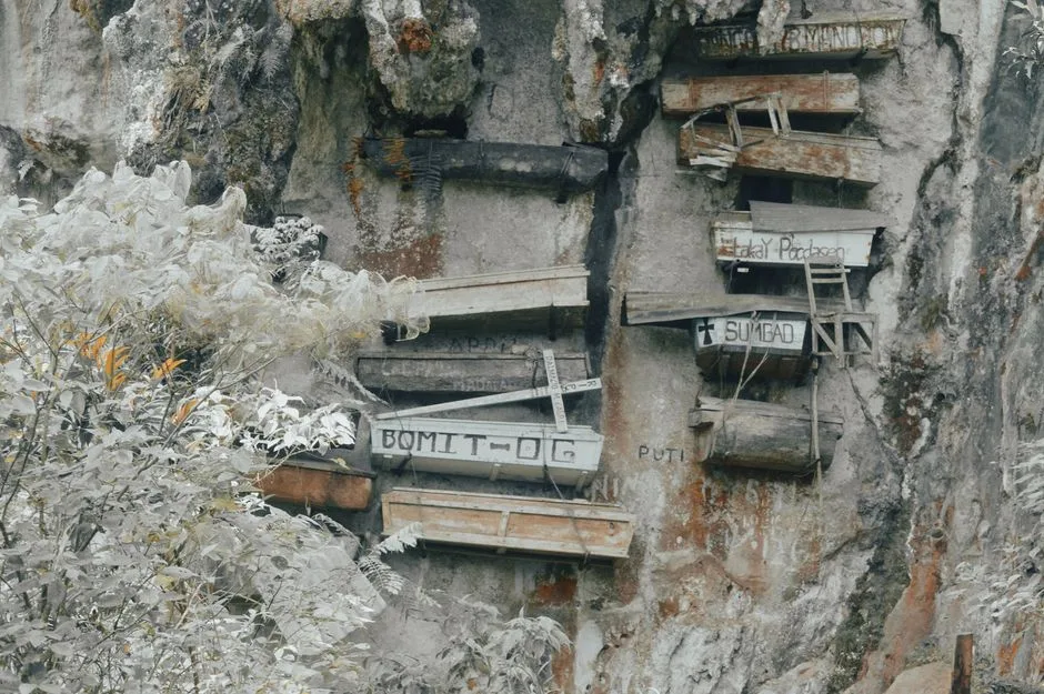
Hanging Coffins
The Igorot people of Sagada have practiced cliff burial for centuries, nailing wooden coffins to the limestone faces of Echo Valley. The belief is that elevating the dead brings them closer to the spirits. You can see the coffins from a short hike down from the town — a guide is required and costs about 500 pesos. Sagada itself is a cool mountain town with cave connections and the best coffee in the Cordilleras.
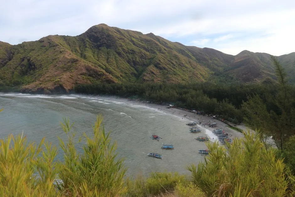
Anawangin Cove
A crescent-shaped cove backed by Agoho pine trees — unusual for a Philippine beach — created when the 1991 Mount Pinatubo eruption deposited volcanic ash and sand that pine seedlings colonised. You reach it by boat from San Antonio and there's nothing there except tents and the sound of waves. No electricity, no phone signal, no buildings. One of the few places left in Luzon where you can camp on a beach with actual silence.
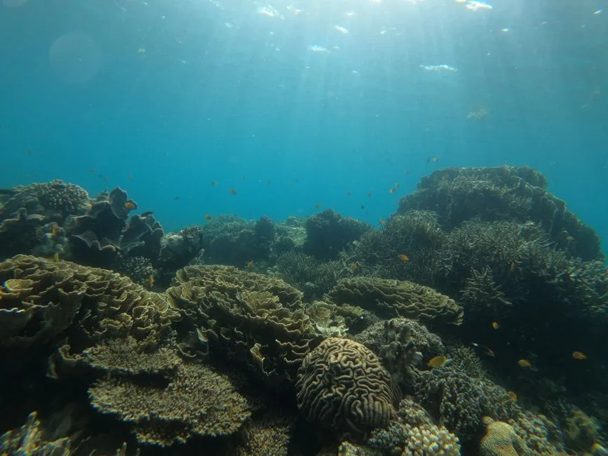
Tubbataha Reefs
A UNESCO World Heritage marine park in the middle of the Sulu Sea, accessible only by liveaboard dive boat from Puerto Princesa during the March-to-June season. Two coral atolls with near-vertical walls dropping hundreds of metres, patrolled by whale sharks, hammerheads, and manta rays. It is one of the top ten dive sites in the world and the permit system keeps it pristine — only a few thousand divers visit per year.
Flights
Fly to Philippines
Compare prices across local & global booking platforms
✈ Flights to Philippines
🏨 Hotels in Philippines
Clicking opens the booking platform. WorldCurio may earn a commission at no extra cost to you.
Did You Know
Philippines Facts
Fascinating things most travellers never learn
The Philippines has about 7,641 islands, but only around 2,000 are inhabited. The number actually changes with the tide — some islets only exist above water at low tide.
The Philippines' island count changes with the tide — officially 7,641, but some low-lying islets only exist above water at low tide. The archipelago has 36,289 km of coastline, the fifth longest in the world.
The Philippines' Tubbataha Reef — a remote UNESCO site — is one of Earth's most pristine coral ecosystems, accessible only 2 months per year. The Coral Triangle, of which the Philippines is a core, contains 76% of all coral species.